
What will winter bring?
Last updated 11/2/2022 at Noon
CODY RHEAULT
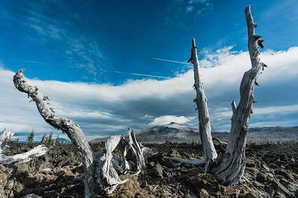
The first snows have fallen in the mountains. Does it portend a snowy winter?
After yet another long hot, dry summer that has extended well into fall here in Central Oregon, a major shift in the weather pattern has finally brought cooler temperatures and much-needed moisture to help quell the wildfires and clear the smoky skies.
Is it just a short-term anomaly or a harbinger of a much more active winter season that may lie ahead? For the past several weeks, forecasters have been sifting through meteorological data seeking clues to answer that very question.
What seems to stand out this time around is how much common ground there is among the prognosticators, and how closely the resulting forecasts mirror last year’s outlook. And yet, maybe that shouldn’t be too surprising since we appear to be heading into a rare third La Niña winter in a row (La Niña is Spanish for “little girl”). It has happened only twice since 1950.
The classic La Niña scenario tends to favor cooler and wetter winters here in the Pacific Northwest. On October 20, the National Weather Service’s Climate Prediction Center issued its three-month (December, January, and February) outlook that calls for cooler and wetter than normal conditions to prevail. More specifically, Washington, the panhandle of Idaho, and northern Oregon should experience cooler temperatures, while the southern half of Oregon extending eastward through Idaho should see temperatures closer to average. It will be wetter than normal nearly everywhere in Washington, Oregon, and Idaho.
Persistent trade winds continue to blow across the eastern tropical Pacific Ocean, producing strong upwelling that results in cooler than normal sea surface temperatures. Atmospheric scientists have dubbed this cold phase of the El Niño Southern Oscillation (ENSO) La Niña. While ENSO isn’t the only climate phenomenon (there are many others), it is still considered the primary driver of global weather patterns. National Oceanic and Atmospheric Administration scientists believe La Niña will stick around through most of the winter, then fade to a neutral ENSO signal by late winter or early spring.
On Saturday, October 22, the Oregon Museum of Science and Industry in Portland played host to the Oregon chapter of the American Meteorological Society’s 30th Annual Winter Weather Forecast Conference.
Seven weather professionals shared their opinions about the important aspects of last winter’s events and what to expect this time around.
Mark Nelsen of Fox TV Channel 12 in Portland pointed out that last winter started out with several storms sweeping through Oregon in November and early December 2021, building an early snowpack in the mountains.
But from the second week in January through March, conditions turned dry and mild.
Only a cool, moist April and May helped add to a meager mountain snowpack.
Rebecca Muessle of the National Weather Service office in Portland produced a map showing that Sisters is still in a moderate drought. However, a second map indicated that although the drought will remain, conditions are expected to improve during the period October through December of this year.
In his forecast highlights, Pete Parsons of the Oregon Department of Forestry claims that “December and January have heightened chances for arctic intrusions, which could be severe.” The Pacific Northwest hasn’t had a widespread arctic air outbreak for the past eight years. Is this the year that winds circulating around the polar vortex weaken enough to allow a batch of frigid air to sag into our region?
So here we are on the eve of a third consecutive La Niña winter. Applying the general rule of thumb that says cooler and wetter weather in the Northwest, we should expect to see lower average temperatures and more rain/snow than normal in the coming months. Yet, Central Oregon remains in a prolonged drought. Why has the “little girl” forsaken us? Or has she?
While central and southern Oregon have experienced a precipitation deficit for a number of years now, it’s not nearly as dry farther north. Portland’s rain/snowfall was close to normal last winter. In Olympia, rainfall was well above average during the heart of the winter season. In fact, several communities even farther north in Western Washington endured widespread flooding as an active jet stream brought one storm after another into the region.
So maybe La Niña has been with us after all. Perhaps the “tried and true” methods used previously to predict seasonal weather can no longer be applied to the Pacific Northwest as a whole.
Oregon Climatologist Larry O’Neill thinks that climate change has made annual weather forecasts less predictable in general.
“It is important to remember that these historical analogs occurred before climate change became more apparent. Winters during recent La Niña events in the last 10 to 15 years have not been quite as cold or wet,” said O’Neill.


Reader Comments(0)